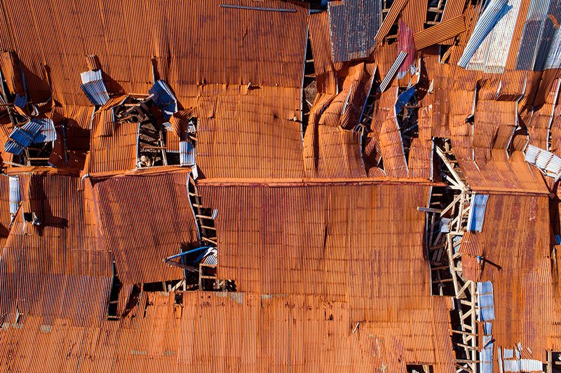
Natural disasters are unpredictable and can lead to severe damage to infrastructure and loss of life. These events can cause widespread power outages and make it challenging for rescue teams to carry out their operations. It is essential to have a reliable and efficient way of mitigating the damage caused by natural disasters to minimize their impact. This is where aerial drones equipped with better intelligence can help.
In this blog post, we will discuss how better aerial drone intelligence can aid surveyors, property developers, and architects to reduce the damage caused by natural disasters and restore power quickly when disaster inevitably strikes.
Rapid Damage Identification
Aerial drones equipped with high-resolution cameras can rapidly identify the areas with maximum damage caused by natural calamities. Surveyors and property developers can use this information to develop better strategies to restore infrastructure quickly, as they can prioritize their actions efficiently.
With drone intelligence, surveyors can also see areas that are inaccessible or too hazardous for human inspection. This becomes especially crucial for emergency responders who need to identify life-threatening areas and evacuate anyone in danger.
Real-Time Insights
Drones can provide real-time insights into the situation on the ground, which can help surveyors and property developers make timely and informed decisions. With drones, surveyors can monitor the level of damage caused during the disaster and assess the impact of their restoration actions. The drones can also provide information on the level of power supply and the extent of the damage to power grids, enabling property developers and architects to plan the restoration processes accordingly.
Improved Communication and Coordination
Effective communication and coordination are critical during emergencies. Aerial drones can provide an added advantage by allowing surveyors and property developers to communicate with team members and emergency responders remotely. With drones, surveyors can monitor the situation on the ground without putting themselves in danger. They can also share real-time footage with team members and emergency responders; this helps them collaborate more effectively and take necessary actions quickly.
Effective Restoration Planning
Aerial drones equipped with high-resolution cameras can capture images and videos of infrastructure before and after the disaster. Surveyors and property developers can use this data to create detailed digital maps. This information can then be used to plan the restoration processes effectively. With real-time data insights provided by drones, surveyors and architects can ensure that their restoration plans are accurate and up-to-date, enabling them to restore power quickly.
Improved Safety Procedures
Safety during emergencies is of utmost importance, and drones can help enforce safety procedures more rigorously. Aerial drones can conduct structural inspections to detect any vulnerabilities in infrastructure, ensuring that safety procedures are in place. This information can help architects and property developers design infrastructure that is more resistant to natural disasters.
Conclusion:
Aerial drones equipped with better intelligence can help surveyors, property developers, and architects to reduce the damage caused by natural disasters and restore power quickly when disaster inevitably strikes. Rapid damage identification, real-time insights, improved communication and coordination, effective restoration planning, and improved safety procedures are all ways in which drones can help during emergencies. Aerial Survey Solutions by Imagineer’s Drone Roof Surveys provides these services and more, making them an indispensable tool for anyone looking to protect their property and infrastructure from natural disasters. With their services, property storytelling for every phase is possible, making them an ideal partner for property developers and architects.


